
Tim Isbell for Mississippi Today
Hurricane warning flags flap in the breeze at Jones Park in Gulfport on Monday morning. (Photo: Tim Isbell for Mississippi Today)
Gulf Coast residents are preparing for what forecasters believe will soon be Hurricane Sally to hit Mississippi directly, bringing “life-threatening storm surge,” hurricane-force winds, and up to two feet of rainfall between now and Wednesday.
As of Monday morning, Sally is expected to make landfall in Mississippi as a Category 1 or Category 2 hurricane. It will likely dump up to 25 inches of rain in parts of Mississippi, and it will likely produce tornadoes and high wind gusts. Hurricane conditions in Mississippi are expected to begin Monday night ahead of a Tuesday landfall.
During a briefing Monday morning, Gov. Tate Reeves said the projection for the path of the slow moving storm had shifted eastward, placing landfall near Biloxi in Harrison County instead of in Louisiana. Under current projections, it is expected to make landfall around 2 a.m. Wednesday and continue to move northeast, meaning it could be exiting Mississippi quickly, but could still have major impacts on the Gulf Coast and in southeast Mississippi.
Reeves said the storm could have sustained winds of 90 miles per hour or higher and storm surges on the Coast of as much as 9 feet.
Local officials issued mandatory evacuations for parts of Hancock County on Sunday, and officials in all three counties along the Gulf Coast warned residents to plan for extended power outages and flash flooding in addition to the coastal flooding that is expected.
“While this storm has ticked to the east overnight, it is anticipated that we are going to bear the brunt of this storm,” Reeves said on Monday morning. “Be prepared for the worst-case scenario. With this storm slowing, it could get worse before it gets better.”
LATEST: Check National Hurricane Center for latest forecasts.
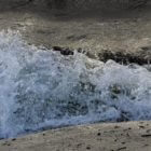
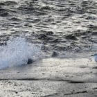
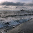
In Waveland on Monday morning, storm surge during high tide had already flooded parts of Beach Boulevard. Residents along the Coast on Monday began boarding up windows and placing sandbags around their property, and boaters along the Coast scrambled to remove their boats from the water to higher ground.
The storm, which is slower moving than many tropical systems, is expected to drop up to two feet of rainfall even far inland. Local officials as far north as Hattiesburg are prepping for potentially devastating flash flooding.
MORE PHOTOS: View our full photo gallery
The post ‘Be prepared for worst-case scenario’: Mississippi braces for Hurricane Sally appeared first on Mississippi Today.
- Legislators haggle over ‘Christmas tree’ spending, immigrant wire transfers, youth court as 2026 session winds down - April 1, 2026
- Lawmakers approve 50-50 joint custody in divorce cases and send bill to the governor - April 1, 2026
- Home mitigation bill heads to governor in yearslong effort to improve disaster resilience in Mississippi - April 1, 2026


